All posts by Scott Hunter

Scott has been living in the Grand Coulee Dam area since 1988 and loving it.

How much water is coming out of that hole?

You might be seeing 2% of the river flow coming through a hole like this.

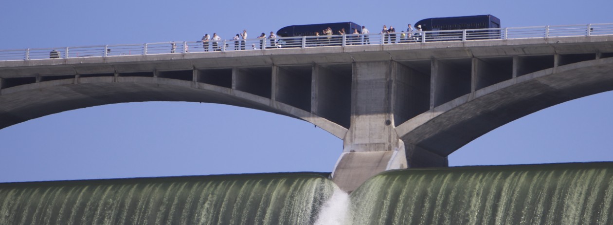
For several weeks, a powerful flow of water has been pounding the river below the dam, rushing from one outlet tube in the dam.

It causes a very slight vibration in my nearby home, so that the door between the kitchen and garage emits a high-pitched squeak. I can’t feel it or otherwise detect the vibration, but when I hear that squeak, I know that if I walk out my front door I’ll see that gigantic, thundering water spout.

So how big is it that water spout?

Flow records indicate there’s about 3.9 kcfs shooting out of that tube. That’s 3,900 cubic feet per second, or 29,000 gallons. Every second.

Water weighs something like 8 pounds per gallon, depending on the temperature, so that comes out to 232,000 pounds per second of water, under pressure, pounding the river 150 feet (guessing) below.

That’s impressive, but when you consider the total flow of the river is right now about 160 kcfs you’re only looking at about 2 percent of the river squeezing through that tube. The rest is making power through the generators.

The funny thing is that just watching 2/100ths of the river make an impressive show of power helps me appreciate the tremendous energy of the river tapped by the dam and sent out into the nation.
Lasers, bulls, wild horses and the best Memorial Day service in the state

There’s so much happening in the Grand Coulee Dam Area this Memorial Day weekend, it’s hard to know where to start.

Isle of Flags

The Isle of Flags honors veterans on Memorial Day.

But rightfully, that has to be an annual service called the Isle of Flags. It’s a tribute to local veterans who’ve passed on, but anybody from anywhere would find this simple, 40-minute ceremony overlooking Lake Roosevelt to be inspiring. More than 500 U.S. flags will fly in tribute at Spring Canyon Cemetery, along with those about to be dedicated.

The Isle of Flags ceremony starts at 11 a.m. Monday.

Cleatis Lacy Memorial Bull Riding and Wild Horse Race

Saturday, May 24 at 4 p.m. at the site of the best rodeo in the state, cheers will echo off the the coulee wall as cowboys take on the toughest 8 seconds in all of sports, riding bulls who know how to throw them like rag dolls. This event will also feature a wild horse race in which teams of three try to harness, saddle and ride through barrels horse so spirited they refuse to be “broke” in the old cowboy sense of the word. Admission is $10, or $8 for students. Kids under 10 get in free. And if you don’t have your kids with you, feel free to watch from the Ridge Riders’ whiskey and beer garden.

A bullrider holds on during the 2012 Cleatis Lacey Bullarama in Grand Coulee.

Largest laser show in North America debuts Saturday at 10 p.m.

On Saturday night at 10 p.m., the U.S. Bureau of Reclamation will debut its new laser light show on the face of Grand Coulee Dam. At more than a mile wide and as high as the Washington Monument, it’s the largest laser light show in North America. And it’s free.

This new show features all-new content on the history of the Columbia River, its people, the dam and its effects on the region and nation. The production and equipment to show it cost $1.6 million and replaces the original show that ran for 25 years.

I’ve seen some preview clips on the Internet, but I’m not going to post them here. Those do the show a disservice, because you cannot get the same effect reducing a mile-wide spectacle to a tiny screen. Just come and see it. The best place to watch it is at the Visitor Center at the dam or in the park just below the VC. But below is photo of people watching the show that ran for 25 years.

Visitors watch the Laser Light Show on the face of Grand Coulee Dam.
Visitors watch the old Laser Light Show on the face of Grand Coulee Dam.


The longest boat ramp on Lake Roosevelt

20140405-174228.jpg

It’s a long way to the water, but Lake Roosevelt is ready and waiting at the end of the ramp at Spring Canyon, the longest launch on the lake.
At this writing, the surface of the lake is 1253 feet above sea level, down 37 vertical feet from full pool.
The launch at Spring Canyon goes down to 1222.
Check the current lake level here.
I talked to three guys pulling out today, and they said it wasn’t a bad ramp. It’s concrete all the way down, and there is a good dock.
That dock is about even with red and green navigational buoys that mark the entrance of the marina in the summer.
This photo will have to suffice, but why is it that fishermen can’t resist saying the equivalent of “You should have been here yesterday!”
“You missed a great shot this morning,” one of the guys at the ramp said. His buddy had been reeling in a resistant rainbow trout that was leaping out of the water when a golden eagle swooped in to try to take it. The big raptor just missed only a few feet from the boat, and the trout eventually met a net >

Lake is still accessible to boats

The  dock at Crescent Bay is high and icy, but the boat launch is still very usable, even if most of the bay is ice in background.
The dock at Crescent Bay is high and icy, but the boat launch is still very usable, even if most of the bay is ice in background.

I had a call from a guy on the coast wondering if he could still launch his boat on Lake Roosevelt this weekend if he brought his son over for a little winter fishing.
The answer: an emphatic yes, with footnotes.
Here’s the lake level situation and more.
Right now (about 3 pm, Sunday, Feb. 9, 2014), the lake level is predicted to “stabilize” at around 1,271 feet above sea level, or about 19 feet below the completely full mark.
That leaves most launches open, including Crescent Bay and Spring Canyon.
That said, you might find your favorite cove iced over. Even Crescent Bay is solid, which hasn’t happened in years.
I’ve talked to guys catching rainbow at what we like to call Geezer Beach, and one fellow told me his group caught two limits on the shore at Swawilla Basin last week.
You can find current lake level in this chart under “Midnight Elevation Level.”
And here’s our list of boat launch elevations.
MINIMUM BOAT LAUNCH ELEVATIONS
Crescent Bay 1265′
Spring Canyon 1222′
Keller Ferry 1229′
Hansen Harbor 1253′
Jones Bay 1266′
Lincoln Mill 1245′
Hawk Creek 1281′
Seven Bays 1227′
Fort Spokane 1247′
Porcupine Bay 1243′
Hunters Camp 1230′
Gifford 1249′
Daisy 1265′
Bradbury Beach 1251′
Kettle Falls 1234′
Marcus Island 1281′
Evans 1280′
North Gorge 1280′
Snag Cove 1277′
French Rocks 1265′
Napoleon Bridge 1280′
China Bend 1277′