When was Franklin D. Roosevelt Lake formed?
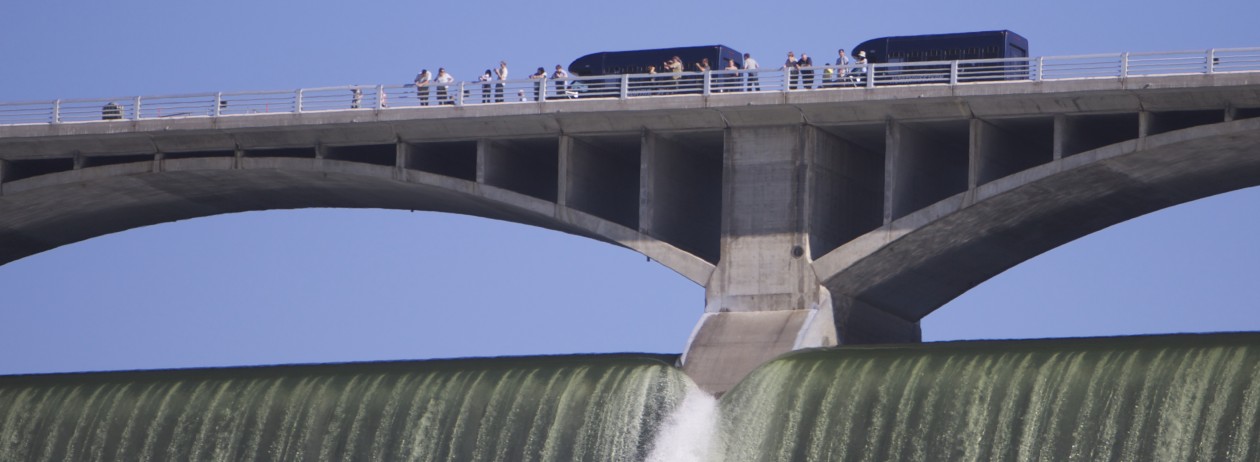
When construction of the Grand Coulee Dam was completed in 1941, the waters of the mighty Columbia River began to backfill behind this enormous concrete structure. As a result, the waters of the once untamed river now swelled to create a 151-mile long reservoir named Franklin D. Roosevelt Lake in honor of the 32nd President of the United States.
What is the Lake Roosevelt National Recreation Area?
Lake Roosevelt is a federally-owned reservoir which is administered by the Bureau of Reclamation. However, recreation on the lake is managed cooperatively by three federal agencies and two Indian tribes.
The National Park Service (NPS) has recreation authority for that portion of the lake and adjacent shoreland comprising the Lake Roosevelt National Recreation Area (LRNRA). The Colville Confederated Tribes and the Spokane Tribe manage recreation along those areas of the lake and shoreline that fall within their reservation boundaries. The two other partners in the management agreement are Bureau of Reclamation and the Bureau of Indian Affairs.
How many campgrounds are there in the LRNRA?
There are 35 campgrounds which are located along the 660 miles of shoreline around Lake Roosevelt. Five are maintained by the Colville Confederated Tribes, two by the Spokane Indian Tribe and 28 by the National Park Service. The facilities provide opporunities for camping, picnicking, boating, swimming and fishing.
Is there a fee for camping?
Camping sites along the lake vary from fee campgrounds with major facilities, picnic areas, swim beaches and interpretive programs, to primitive boat-in campgrounds.
Which campground is closest?
The closest NPS campground is located at Spring Canyon on SR174; turn left approximately three miles east of the town of Grand Coulee.
There are 87 campsites including RV (dump station but no hookups), tent and group camping sites. Reservations are available online at www.recreation.gov or at 877-444-6777. A fee is charged.
What else is at Spring Canyon?
Spring Canyon has a beautiful sandy beach and adjacent shaded picnic area including grills and playground equipment. There are restrooms plus boat launching. A fee is charged.
Where can I hike in the LRNRA?
Lake Roosevelt National Recreation Area consists mainly of Lake Roosevelt and has very little land base. As a result, there are few hiking trails within the park. There is a self-guided nature trail at Spring Canyon, which starts at the campground. There are also trails at Fort Spokane, and Kettle Falls. When the lake level is low, you can walk many miles of interesting shoreline.
Does the NPS offer programs?
The National Park Service often offers ranger-conducted canoe trips on Crescent Bay Lake, below the city of Grand Coulee.
The group meets in the parking lot at Spring Canyon and car-caravans to the small lake. All canoeing equipment (canoes, paddles, life vests) is provided. First come, first served.
The adventure is not meant to be instructional in the operation of a canoe, but rather a nature “walk” on water. Visitors often see beavers,deer, muskrats, great blue herons, Canada geese, turtles, frogs and nesting cliff swallows.
Other NPS-conducted activities at Spring Canyon include:
• campfire programs at the amphitheater
• hikes on the Bunchgrass Prairie Trail
• children’s environmental education activities.
• Contact NPS before making plans. All programs are subject to change. Call 509-633-9441 or check campground bulletin boards.
Where are the other major NPS campgrounds?
Major campgrounds are located at: Keller Ferry, Fort Spokane, Porcupine Bay and Kettle Falls.
Keller Ferry is about 14 miles from Spring Canyon by boat, or 15 miles overland from the Highway 2 cut-off near Wilbur. This area includes a marina, store, and free ferry across the lake to the Colville Reservation.
Fort Spokane, built in 1880 and used by the US Army until 1898, became an Indian agency, boarding school and tuberculosis hospital until the late 1920s. It’s about 50 miles up the lake from Spring Canyon at the confluence of the Columbia and Spokane Rivers.
To see Fort Spokane, take SR174 to Highway 2, east, watch for road signs and turn north at Davenport on SR25.
Besides some of the original outposts, there is a visitor center and a trail. A free living history program is conducted on Sunday mornings at 11 a.m.
