What a beautiful place

View from the air, looking south
When seen from the air, the relationship of Grand Coulee Dam to Steamboat Rock (far right middle) becomes apparent. It's the rock the Ice Age Floods failed to wash away from what is now the Grand Coulee.

I love the spring. As the local vegetation starts to green up, little tufts of green grass start to grow among the sagebrush. Soon dozens of varieties of wildflowers will spring up.

Our lakes are an obvious asset, but to those unfamiliar with our semi-arid desert, a less obvious thing of beauty (perhaps especially if you’re here from a more tree friendly section of the state) is our landscape full of hiking areas.

One of the most popular in the late spring is Steamboat Rock, the namesake landmark of Steamboat Rock State Park. It’s a great hike to the top, at one point very steep, but the vista is a reward you won’t forget. You can see the big rock that stands in the middle of the Grand Coulee back in the distance in the photo.

If you want to take the hike, let a park ranger know you’re heading up to the top, just so they’re aware someone is up there and to let them give you any tips you might need to know.

If you go, tell us what what you think in the comments!
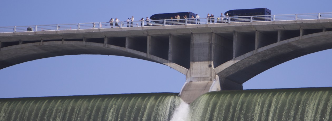
How many dams are on the Columbia River?

Altogether, a total of 11 dams have been built on the river in the United States as it winds its way from the Canadian border toward the Pacific Ocean; Grand Coulee Dam is the keystone of the Columbia River system dams. Five other dams in the Big Bend region of the river also offer facilities for visitors — Chief Joseph Dam on Highway 17 in Bridgeport; Wells Dam south of Brewster on Highway 97; Rocky Reach Dam north of Wenatchee on Highway 97; Wanapum Dam six miles south of the I-90 crossing of the Columbia; and Priest Rapids Dam on Highway 243.

These are all part of some 32 dams in the land mass drained by the Columbia River system (including other rivers), an area roughly the size of France.

When was Grand Coulee Dam built and by whom?

The U.S. Bureau of Reclamation began construction of Grand Coulee Dam in 1933 as the key structure in its multipurpose Columbia Basin Project. It has since become the linchpin in harnessing the second largest river in the United States. It took nine years to build Grand Coulee Dam, but even more years of battling and political maneuvering before construction started. While it was recognized early in the century that the Columbia Basin had rich farmland that needed only water to flourish, the method for providing that water caused much controversy. A Spokane group insisted upon a 134- mile gravity flow canal from Lake Pend Oreille to the Basin, while a Wenatchee/central Washington group favored building a big dam on the Columbia at Grand Coulee. The battle raged for 13 years. At its conclusion, President Franklin D. Roosevelt authorized $60 million to get the dam project started.

In the Grand Coulee, life changed dramatically and quickly once work on the dam began in 1933. Not only did the undertaking of this massive project change forever the shape of the river, but overnight it created towns where nothing but sagebrush, sand and rocks had previously existed.

Thousands came to the Grand Coulee looking for work in the midst of the Depression. They worked around the clock to finish the dam by 1942.

A Quick Overview

Welcome to the Grand Coulee Dam area of Washington state.
Just for a quick overview, here are a few facts about the area to help you decide if you’d like to visit.

We’re about 100 miles from the eastern border with Idaho, on the dry side of Washington. Seattle-ites come here to get away from rain, and we’re even a lot drier than Spokane, about 50 miles to the east (90 by road). I used to drive all over eastern Washington on  a daily basis and routinely found it cloudier in Spokane than elsewhere, due to the mountains to the east that block the weather from moving further inland.

The dam and surrounding towns are in the northeastern tip of central Washington’s semi-arid desert, which is tucked between wheat land to the south and east, and forest, to the north and east.

We’re surrounded by water and undeveloped beaches. From my house in Coulee Dam (just below the dam in the photo above) I can drive 5 to 15 minutes in any direction to reach one of five boat launches on three different lakes offering more than 600 miles of shoreline. Beaches are mostly undeveloped because the land is federally owned and open to everyone. State, federal and private campgrounds are top notch and drop-dead gorgeous.

You won’t find any national motel chains, but many local owners have taken great pride in their facilities and can offer you a very comfortable stay. I’ve had many people tell me they were pleasantly surprised.

We have a good selection of restaurant types, including Asian, Mexican, typical American, pizza/Italian, breakfast nookish and progressive café. I like them all.

We have great hiking trails, spectacular views and abundant wildlife and fishing, three golf courses within driving distance, and even a great little airport for you pilots.

If any of this interests you, take a closer look around.