Tag Archives: Water

Lake Roosevelt level is dropping

The flood control level needed for Lake Roosevelt is set in the blue triangles for 2015, compared to the 2014 history depicted by the pink dotted line. -- USBR graph
The flood control level needed for Lake Roosevelt is set in the blue triangles for 2015, compared to the 2014 history depicted by the pink dotted line. — USBR graph

The level of Lake Roosevelt has already dropped to to a level not predicted until March, in a forecast put out in mid-January, 2015.

On Friday, Jan. 30, the lake surface was at about 1,276 feet above sea level, which will put out of reach several boat launches on the lake, but certainly not all. (See the list below).
The deepest access is offered at the Spring Canyon launch near Grand Coulee.

The U.S. Bureau of Reclamation, which operates Grand Coulee Dam, which controls the lake, had published an estimate of the lake level drop this year showing a flood control schedule that would have still held the level at full pool until the end of February and eventually dropping to about 1,243 in April, not as far down as in 2014. But factors including weather and power demand can be hard to predict.

MINIMUM BOAT LAUNCH ELEVATIONS
Crescent Bay 1265′
Spring Canyon 1222′
Keller Ferry 1229′
Hansen Harbor 1253′
Jones Bay 1266′
Lincoln Mill 1245′
Hawk Creek 1281′
Seven Bays 1227′
Fort Spokane 1247′
Porcupine Bay 1243′
Hunters Camp 1230′
Gifford 1249′
Daisy 1265′
Bradbury Beach 1251′
Kettle Falls 1234′
Marcus Island 1281′
Evans 1280′
North Gorge 1280′
Snag Cove 1277′
French Rocks 1265′
Napoleon Bridge 1280′
China Bend 1277′
Lake will be coming up over 4th of July weekend

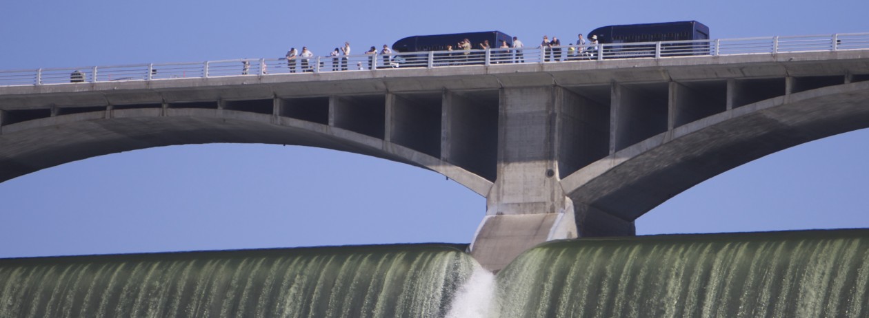
With a little less than 1.4 million gallons per second flowing out of Lake Roosevelt and down the Columbia River Tuesday morning, about 75,000 gallons per second were spilling over the top.
With a little less than 1.4 million gallons per second flowing out of Lake Roosevelt and down the Columbia River July 1, about 75,000 gallons per second were spilling over the top.

With Lake Roosevelt about 4 feet from being full, the Bureau of Reclamation expects the lake to rise starting July 3 by up to a half foot each day through the weekend.

Filling the lake lifts accumulated debris off the shores and into the water where it can be dangerous to boaters.

The Bureau of Reclamation is advising people camping along the Lake Roosevelt shoreline over the July 4 weekend to be aware of potential dangers that could exist due to rapidly rising lake levels.

“When camping along the shoreline, it is recommended that tents and other belongings be kept well away from the water’s edge,” said Public Affairs Officer Lynne Brougher. “Although the lake is a popular vacation spot, it is also a working reservoir that supplies water for hydroelectric facilities at Grand Coulee Dam which can result in rapid fluctuations.”

Brougher says campsites that are too close to the water’s edge could potentially become flooded and boats that are not properly anchored or secured could drift out into the lake and become a safety hazard.

Reclamation must adhere to the court-ordered 2008/2010 FCRPS Biological Opinion requiring the lake to be at the full pool elevation of 1,290 feet above sea level between late June and early July. It was at 1,286 feet above sea level Tuesday evening.